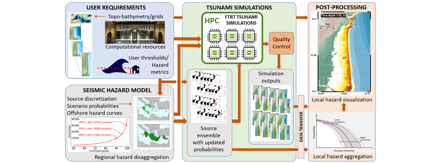
Local Workflow for Probabilistic Tsunami Hazard Analysis

Probabilistic Tsunami Hazard Analysis (PTHA) quantifies the probability of a tsunami metric (for example the flow depth) exceeding a given threshold, at a given location, within a given time interval. Such assessments are needed for insurance and reinsurance, coastal planning, and the designation of evacuation zones and evacuation routes (e.g. Tonini et al., 2021). Such an assessment needs to cover every tsunamigenic earthquake likely to pose a hazard to the coastline of interest. This can result in tens, or even hundreds, of thousands of different scenarios – undersea earthquakes with different magnitudes, locations, depths, source mechanisms, and slip distributions. Each may generate a tsunami wave with different amplitude, wavelength, or directivity such that the impact of the tsunami wave at a given coastline needs to be estimated by performing a numerical simulation for every single scenario. The computational cost of this was so colossal that previously it was only possible to estimate the offshore hazard and to obtained statistical models for the tsunami impact along stretches of coastlines covering many kilometers.
With advances in High Performance Computing (HPC), improved access to HPC resources, and the developments of Faster-Than-Real-Time tsunami simulation codes, it is now possible to simulate the inundation of tsunami waves onshore down to scales of the order of 5 or 10 meters. A workflow for this so-called Local PTHA is depicted in the image above. Tsunami inundation hazard maps can now be generated through the simulation of tens of thousands of scenarios at high spatial resolution, something that was not possible even 10-15 years ago. There is expertise within GTM of how to set-up, execute, and interpret local PTHA.